KSTL - Lambert St Louis International
Located in St Louis, MO, USA
ICAO - KSTL, IATA - STL, FAA ID - STL
Airport Type
Joint Civil / Military
Lat/Long
N38-44.9/W090-22.2
Elevation (ft)
617
Fuel Available
AVGAS JET
Current UTC
1:45:52 AM (-6.00)
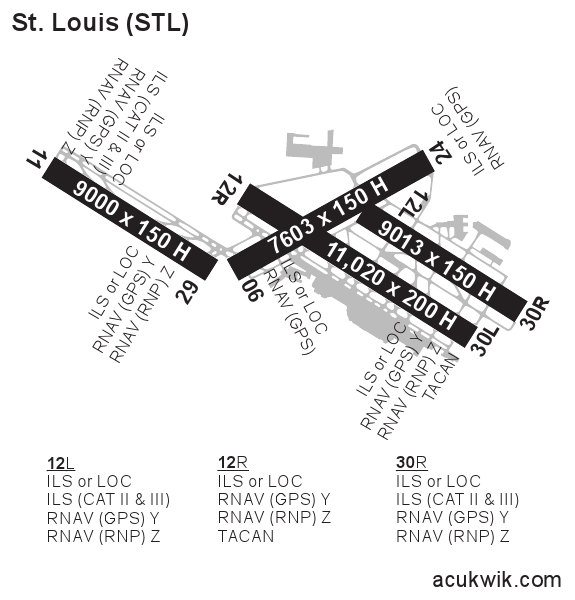
Approaches
ILS LOC GPS
Longest Primary Runway (ft)
11020 x 150, 12R/30L
Runway Surface
Concrete/Grooved
PCN
Local Standard Time
8:45:52 PM
More Airport Information (Click to expand)
Airport Light Intensity
HIGH
US Customs Pre-Clearance
Yes
DST
2nd Sun in Mar 0200L to 1st Sun in Nov 0200L
Distance from City
10 MILES NW OF CITY
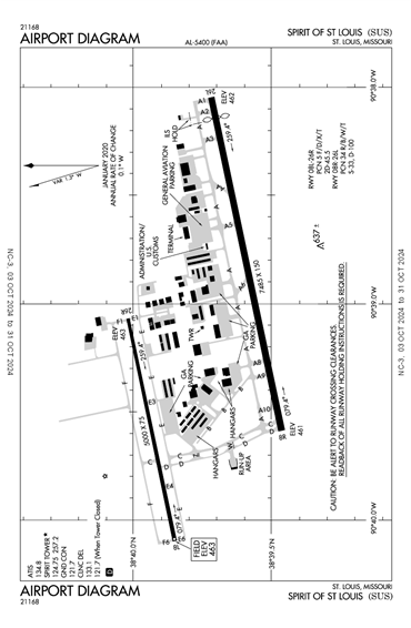
Runway Diagram
FAA Diagram
Google Satellite Map of KSTL
Airport Distance Calculator
The distance from to is
Nautical Miles
Airport Restrictions and Information
FBOs
Fuel Info
Brand INDEPENDENT
Hotels
Marriott St Louis Airport
Renaissance St Louis Arpt
Crowne Plaza St Louis Arpt