KOJC - Johnson County Executive
Located in Olathe, KS, USA
ICAO - KOJC, IATA - OJC, FAA ID - OJC
Airport Type
Civil
Lat/Long
N38-50.9/W094-44.3
Elevation (ft)
1096
Fuel Available
AVGAS JET
Current UTC
12:07:02 PM (-6.00)
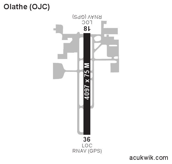
Approaches
LOC GPS
Longest Primary Runway (ft)
4097 x 75, 18/36
Runway Surface
Concrete
Local Standard Time
6:07:02 AM
More Airport Information (Click to expand)
Airport Light Intensity
MEDIUM
US Customs Pre-Clearance
No
Airport Ownership
Publicly Owned
Facility Use
Open to the Public
DST
2nd Sun in Mar 0200L to 1st Sun in Nov 0200L
Control Tower Hours
0700-2100L
Distance from City
4 MILES SE OF CITY
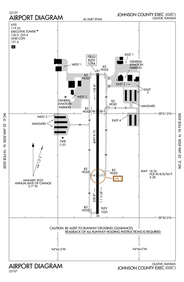
Runway Diagram
FAA Diagram
Google Satellite Map of KOJC
Airport Distance Calculator
The distance from to is
Nautical Miles
Airport Restrictions and Information
FBOs
Address
15325 S Pflumm Rd,
Olathe, KS 66062
Toll Free Phone
+1 800 720 5222
Tel After Hours
+1 913 302 9129
Fuel Info
Brand PHILLIPS 66
Prices Not Updated Last 90 DAYS
Prices Not Updated Last 90 DAYS
Address
12901 West 151st Ste B,
Olathe, KS 66062
Fuel Info
Brand AVFUEL
Prices Not Updated Last 90 DAYS
Prices Not Updated Last 90 DAYS
Hotels
Candlewood Suites
Address
15490 S Rogers Rd
Olathe KS 66062
USA
Hampton Inn
Address
12081 S. Strang Line Road
Olathe KS 66062
USA
Holiday Inn Express
Address
7580 W 135th St
Overland Park KS 66223
USA
La Quinta
Address
20570 West 151st St
Olathe KS 66061
USA