VVCR - Khanh Hoa-Nha Trang/Cam Ranh International
Located in Khanh Hoa, VIETNAM
ICAO - VVCR, IATA - CXR
Airport Type
Joint Civil / Military
Lat/Long
N11-59.9/E109-13.2
Elevation (ft)
43
Fuel Available
JET
Current UTC
5:46:27 AM (+7.00)
Approaches
ILS VOR/DME
Longest Primary Runway (ft)
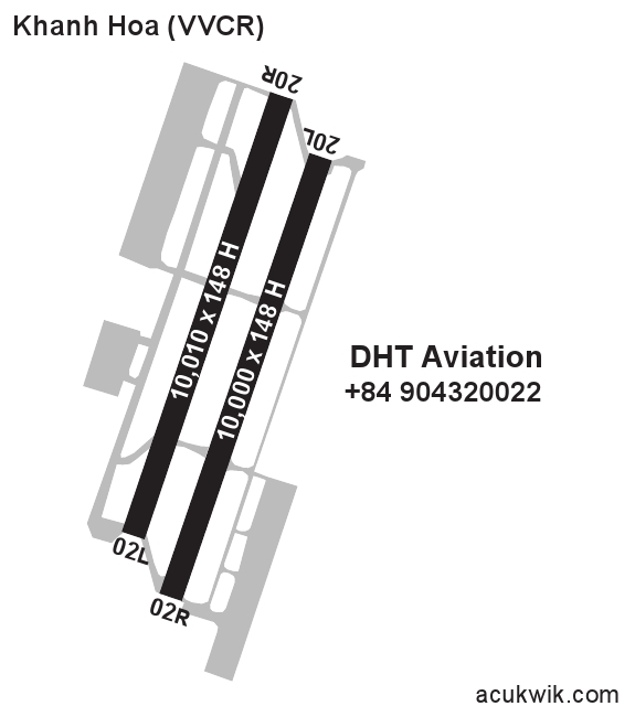
10010 x 148, 02L/20R
Runway Surface
Concrete
PCN
Local Standard Time
12:46:27 PM
More Airport Information (Click to expand)
Airport Light Intensity
HIGH
US Customs Pre-Clearance
No
DST
None (No Daylight Savings Time observed)
Distance from City
28 KM S OF CITY
Runway Diagram
Google Satellite Map of VVCR
Airport Distance Calculator
The distance from to is
Nautical Miles
Airport Restrictions and Information
Supervising Agents
Tel After Hours
+84 91 323 3534
Tel After Hours
+66 2 329 5938
Flight Support Organizations
Tel After Hours
+66 80 058 3174