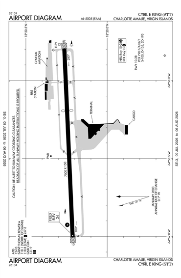
TIST - Cyril E King - Charlotte Amalie
Located in St Thomas, VIRGIN ISLANDS (US)
ICAO - TIST, IATA - STT, FAA ID - STT
Airport Type
Civil
Lat/Long
N18-20.2/W064-58.4
Elevation (ft)
24
Fuel Available
AVGAS JET
Current UTC
5:00:15 AM (-4.00)
Approaches
ILS VOR/DME
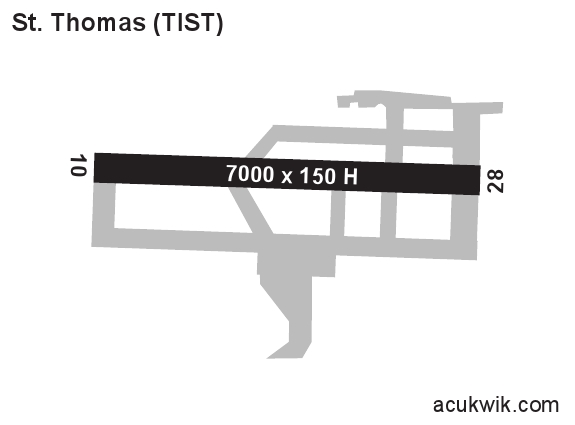
Longest Primary Runway (ft)
7000 x 150, 10/28
Runway Surface
Asphalt
PCN
Local Standard Time
1:00:15 AM
More Airport Information (Click to expand)
Airport Light Intensity
HIGH
US Customs Pre-Clearance
Yes
DST
None (No Daylight Savings Time observed)
Control Tower Hours
0600-2230L
Distance from City
3 KM W OF TOWN
Runway Diagram
FAA Diagram
Google Satellite Map of TIST
Airport Distance Calculator
The distance from to is
Nautical Miles
Airport Restrictions and Information
Fuel Info
Prices Not Updated Last 90 DAYS
Prices Not Updated Last 90 DAYS
Fuel Info
Prices Not Updated Last 90 DAYS
Prices Not Updated Last 90 DAYS
Flight Support Organizations
Tel After Hours
+598 9968 4326