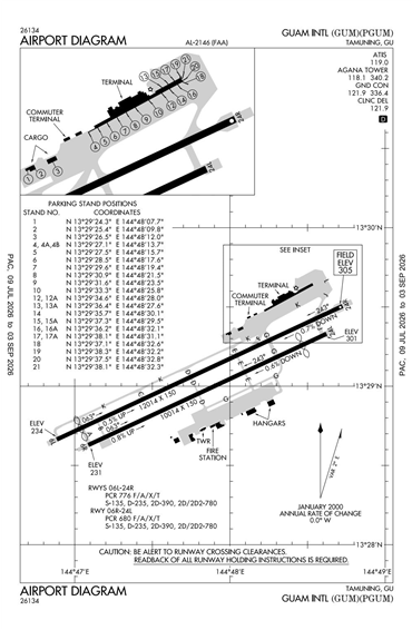
PGUM - A B Won Pat Guam International
Located in Agana, GUAM
ICAO - PGUM, IATA - GUM, FAA ID - GUM
Airport Type
Civil
Lat/Long
N13-29.0/E144-47.8
Elevation (ft)
305
Fuel Available
AVGAS JET
Current UTC
11:46:53 AM (+10.00)
Approaches
ILS/DME VOR
Longest Primary Runway (ft)
12014 x 150, 06L/24R
Runway Surface
Asph/Conc/Grvd
PCN
Local Standard Time
9:46:53 PM
More Airport Information (Click to expand)
Airport Light Intensity
HIGH
US Customs Pre-Clearance
No
DST
None (No Daylight Savings Time observed)
Distance from City
5 KM NE OF TOWN
FAA Diagram
Google Satellite Map of PGUM
Airport Distance Calculator
The distance from to is
Nautical Miles
Airport Restrictions and Information
Flight Support Organizations
Tel After Hours
+971 4 585 5689