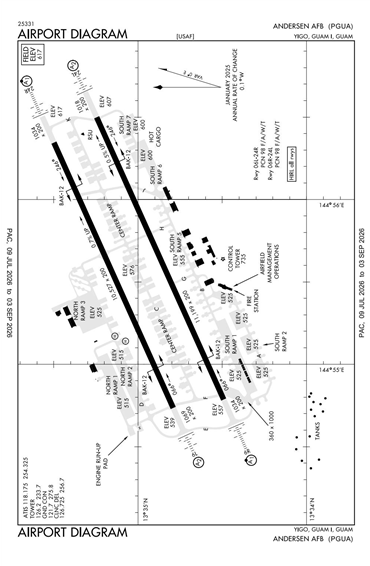
PGUA - Andersen AFB
Located in Guam Island, GUAM
ICAO - PGUA, IATA - UAM
Airport Type
Military
Lat/Long
N13-35.0/E144-55.8
Elevation (ft)
618
Fuel Available
JET ONLY
Current UTC
11:44:33 AM (+10.00)
Approaches
ILS/DME
Longest Primary Runway (ft)
11200 x 200, 06R/24L
Runway Surface
Asphalt/Concrete
PCN
Local Standard Time
9:44:33 PM
More Airport Information (Click to expand)
Airport Light Intensity
HIGH
US Customs Pre-Clearance
No
DST
None (No Daylight Savings Time observed)
Distance from City
19 KM NE OF GUAM
FAA Diagram
Google Satellite Map of PGUA
Airport Distance Calculator
The distance from to is
Nautical Miles
Airport Restrictions and Information