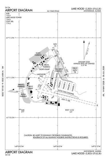
PALH - Lake Hood
Located in Anchorage, AK, USA
ICAO - PALH, FAA ID - LHD
Airport Type
Civil
Lat/Long
N61-11.2/W149-57.9
Elevation (ft)
79
Fuel Available
AVGAS JET
Current UTC
4:26:23 AM (-9.00)
Approaches
VFR
Longest Primary Runway (ft)
4541 x 188, E/W
Runway Surface
Water
Local Standard Time
8:26:23 PM
More Airport Information (Click to expand)
Airport Light Intensity
NO LIGHT
US Customs Pre-Clearance
No
DST
2nd Sun in Mar 0200L to 1st Sun in Nov 0200L
Distance from City
3 MILES SW OF CITY
FAA Diagram
Google Satellite Map of PALH
Airport Distance Calculator
The distance from to is
Nautical Miles