PAKT - Ketchikan International
Located in Ketchikan, AK, USA
ICAO - PAKT, IATA - KTN, FAA ID - KTN
Airport Type
Civil
Lat/Long
N55-21.2/W131-42.7
Elevation (ft)
92
Fuel Available
AVGAS JET
Current UTC
2:59:40 AM (-9.00)
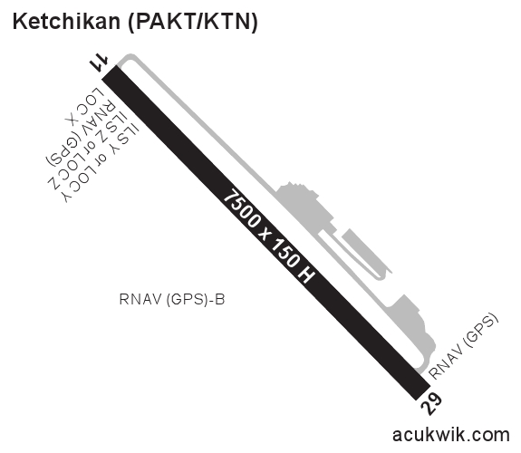
Approaches
ILS/DME GPS
Longest Primary Runway (ft)
7500 x 150, 11/29
Runway Surface
Asphalt/Grooved
PCN
Local Standard Time
6:59:40 PM
More Airport Information (Click to expand)
Airport Light Intensity
HIGH
US Customs Pre-Clearance
No
DST
2nd Sun in Mar 0200L to 1st Sun in Nov 0200L
Airport Hours
Sep-May 0600-2130L, Jun-Aug 0600-2200L
Control Tower Hours
See airport hours
Distance from City
1 MILE W OF CITY
Runway Diagram
FAA Diagram

Google Satellite Map of PAKT
Airport Distance Calculator
The distance from to is
Nautical Miles
Airport Restrictions and Information
Fuel Info
Brand AVFUEL
Price/Gallon
Last Updated: 24 Jun 2026
Last Updated: 24 Jun 2026
Fuel Info
Brand INDEPENDENT
Price/Gallon
Last Updated: 27 Jun 2026
Last Updated: 27 Jun 2026