Kentucky Dam State Park

Located in Gilbertsville, KY, USA

FAA ID - M34

Airport Type 
Civil 
Lat/Long 
N37-00.6/W088-18.0 
Elevation (ft) 
351 
Fuel Available 
AVGAS JET 
Current UTC 
9:23:18 AM (-6.00) 
Approaches 
VFR 
Longest Primary Runway (ft) 
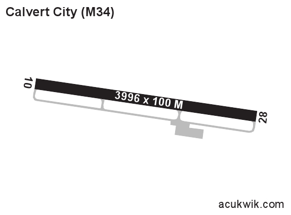
3997 x 100, 10/28 
Runway Surface 
Asphalt 
Local Standard Time 
3:23:18 AM 
More Airport Information (Click to expand)
Airport Light Intensity
MEDIUM
Airport of Entry
No
Customs
No
US Customs Pre-Clearance
No
Slots Required
No
Handling Mandatory
No
Airport Website
Airport Manager Phone
Airport Ownership
Publicly Owned
Facility Use
Open to the Public
DST
2nd Sun in Mar 0200L to 1st Sun in Nov 0200L
Sunrise
06:55 AM
Sunset
05:18 PM
Open 24 Hours
Yes
Airport Hours
H24
Variation
03W
Distance from City
3 MILES SE OF CITY
Unicom Frequency
123.0
CTAF Frequency
123.0
Runway Diagram
Google Satellite Map of M34
Airport Distance Calculator
From:
To:

The distance from to is

Nautical Miles

FBOs

FBO Name
Fuel Info
Address
861 E 5th Avenue, PO Box 36,
Calvert City, KY 42029-7502
Phone
+1 270 395 7138
Fax
+1 270 395 5554
Email
Website
Frequency
122.8

Fuel Info

Brand TITAN
Prices Not Updated Last 90 DAYS
Hotels
Name and Contact Info
Address
Distance
Price range
Days Inn Calvert City
Phone
+1 270 632 4273
Website
Address
75 Campbell Dr
Calvert City KY 42029
USA
Distance
5 Min
Price range
$80-120
KY Dam Village State Park Resort
Phone
+1 270 362 4271
Website
Address
113 Administration Drive
Gilbertsville KY 42044
Distance
5 Min
Price range
$85-125
Car Rental
ENTERPRISE
HERTZ
Phone
+1 270 362 6064