KXWA - Williston Basin International
Located in Williston, ND, USA
ICAO - KXWA, IATA - XWA, FAA ID - XWA
Airport Type
Civil
Lat/Long
N48-15.6/W103-45.0
Elevation (ft)
2356
Fuel Available
AVGAS JET
Current UTC
12:33:06 AM (-6.00)
Approaches
ILS LOC GPS
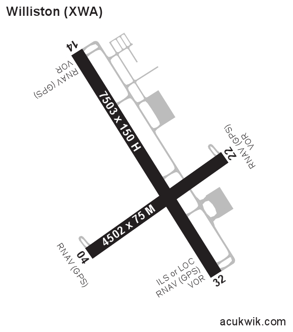
Longest Primary Runway (ft)
7503 x 150, 14/32
Runway Surface
Concrete/Grooved
PCN
Local Standard Time
7:33:06 PM
More Airport Information (Click to expand)
Airport Light Intensity
HIGH
US Customs Pre-Clearance
No
DST
2nd Sun in Mar 0200L to 1st Sun in Nov 0200L
Distance from City
9 MILES NW OF CITY
Runway Diagram
FAA Diagram
Google Satellite Map of KXWA
Airport Distance Calculator
The distance from to is
Nautical Miles
Airport Restrictions and Information