KSLN - Salina Regional
Located in Salina, KS, USA
ICAO - KSLN, IATA - SLN, FAA ID - SLN
Airport Type
Civil
Lat/Long
N38-47.4/W097-39.1
Elevation (ft)
1288
Fuel Available
AVGAS JET
Current UTC
4:10:31 PM (-6.00)
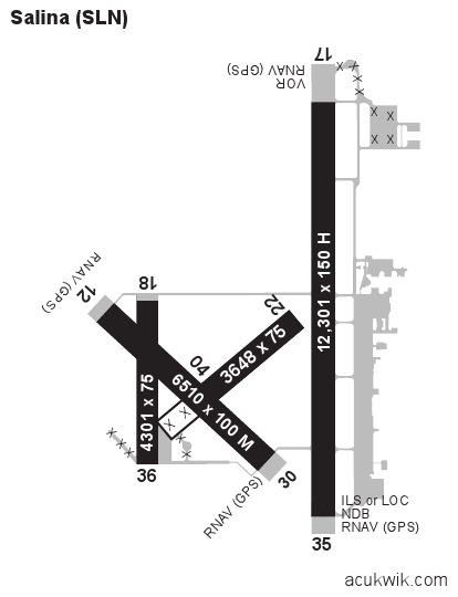
Approaches
ILS GPS VOR
Longest Primary Runway (ft)
12301 x 150, 17/35
Runway Surface
Asphalt/Concrete
PCN
Local Standard Time
11:10:31 AM
More Airport Information (Click to expand)
Airport Light Intensity
HIGH
US Customs Pre-Clearance
No
DST
2nd Sun in Mar 0200L to 1st Sun in Nov 0200L
Control Tower Hours
0700-2300L
Distance from City
3 MILES SW OF CITY
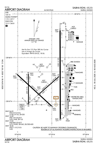
Runway Diagram
FAA Diagram
Google Satellite Map of KSLN
Airport Distance Calculator
The distance from to is
Nautical Miles
Airport Restrictions and Information
Fuel Info
Brand AVFUEL
Price/Gallon
Last Updated: 14 Jul 2026
Last Updated: 14 Jul 2026
Hotels
Country Inn & Suites Salina
Courtyard Marriott Salina
Hampton Inn & Suites Salina