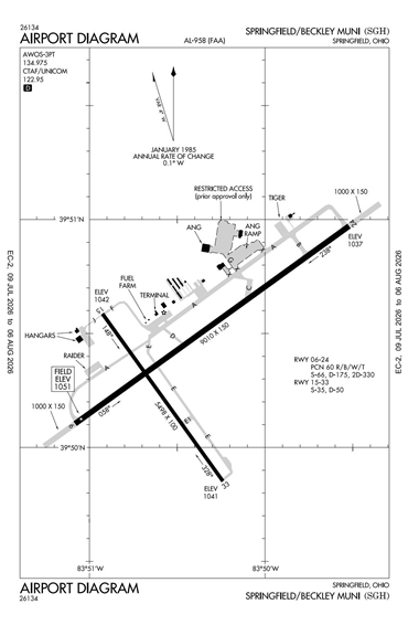
KSGH - Springfield/Beckley Municipal
Located in Springfield, OH, USA
ICAO - KSGH, IATA - SGH, FAA ID - SGH
Airport Type
Joint Civil / Military
Lat/Long
N39-50.4/W083-50.4
Elevation (ft)
1051
Fuel Available
AVGAS JET
Current UTC
3:21:52 AM (-5.00)
Approaches
GPS
Longest Primary Runway (ft)
9010 x 150, 06/24
Runway Surface
Asph/Conc/Grvd
PCN
Local Standard Time
11:21:52 PM
More Airport Information (Click to expand)
Airport Light Intensity
HIGH
US Customs Pre-Clearance
No
DST
2nd Sun in Mar 0200L to 1st Sun in Nov 0200L
Control Tower Hours
0800-1630L Tu-F
Distance from City
5 MILES SSW OF CITY
FAA Diagram
Google Satellite Map of KSGH
Airport Distance Calculator
The distance from to is
Nautical Miles
Airport Restrictions and Information
Hotels
Courtyard Springfield Downtown