KRUT - Rutland/Southern Vermont Regional
Located in Rutland, VT, USA
ICAO - KRUT, IATA - RUT, FAA ID - RUT
Airport Type
Civil
Lat/Long
N43-31.8/W072-57.0
Elevation (ft)
787
Fuel Available
AVGAS JET
Current UTC
7:40:04 PM (-5.00)
Approaches
ILS LOC GPS
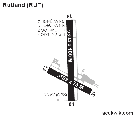
Longest Primary Runway (ft)
5304 x 100, 01/19
Runway Surface
Asphalt/Grooved
PCN
Local Standard Time
3:40:04 PM
More Airport Information (Click to expand)
Airport Light Intensity
HIGH
US Customs Pre-Clearance
No
DST
2nd Sun in Mar 0200L to 1st Sun in Nov 0200L
Control Tower Hours
0800-2000L
Distance from City
5 MILES S OF CITY
Runway Diagram
Google Satellite Map of KRUT
Airport Distance Calculator
The distance from to is
Nautical Miles
Airport Restrictions and Information
Hotels
Killington Mountain Lodge