KPNE - Northeast Philadelphia
Located in Philadelphia, PA, USA
ICAO - KPNE, IATA - PNE, FAA ID - PNE
Airport Type
Civil
Lat/Long
N40-04.9/W075-00.6
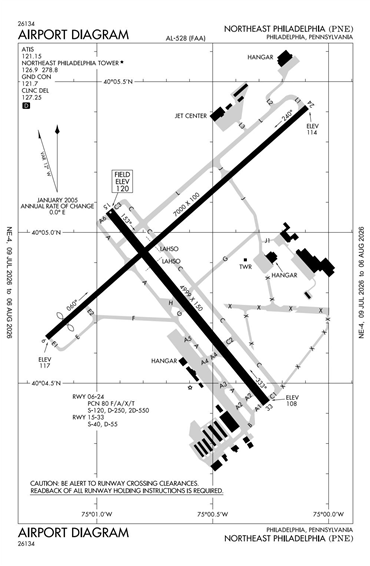
Elevation (ft)
120
Fuel Available
AVGAS JET
Current UTC
2:21:13 AM (-5.00)
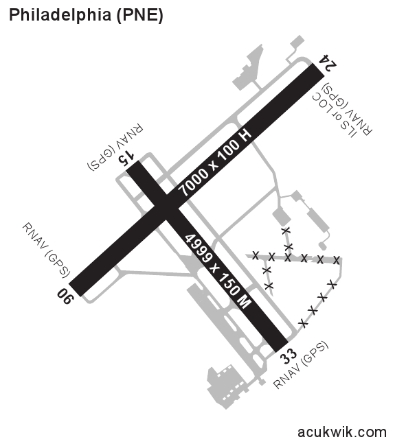
Approaches
ILS LOC GPS
Longest Primary Runway (ft)
7000 x 100, 06/24
Runway Surface
Asphalt/Grooved
PCN
Local Standard Time
10:21:13 PM
More Airport Information (Click to expand)
Airport Light Intensity
HIGH
US Customs Pre-Clearance
No
DST
2nd Sun in Mar 0200L to 1st Sun in Nov 0200L
Control Tower Hours
0600-2300L
Distance from City
10 MILES NE OF CITY
Runway Diagram
FAA Diagram
Google Satellite Map of KPNE
Airport Distance Calculator
The distance from to is
Nautical Miles
Airport Restrictions and Information
Fuel Info
Brand INDEPENDENT
Hotels
Four Points by Sheraton Arpt