KPLK - M. Graham Clark Downtown
Located in Point Lookout, MO, USA
ICAO - KPLK, IATA - PLK, FAA ID - PLK
Airport Type
Civil
Lat/Long
N36-37.6/W093-13.7
Elevation (ft)
940
Fuel Available
AVGAS JET
Current UTC
4:37:17 PM (-6.00)
Approaches
GPS
Longest Primary Runway (ft)
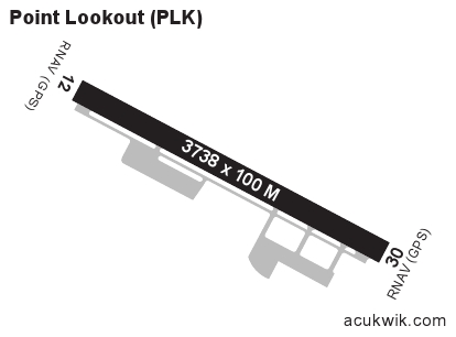
3738 x 100, 12/30
Runway Surface
Asphalt/Grooved
Local Standard Time
11:37:17 AM
More Airport Information (Click to expand)
Airport Light Intensity
MEDIUM
US Customs Pre-Clearance
No
DST
2nd Sun in Mar 0200L to 1st Sun in Nov 0200L
Distance from City
1 MILE S OF CITY
Runway Diagram
Google Satellite Map of KPLK
Airport Distance Calculator
The distance from to is
Nautical Miles
Fuel Info
Brand PHILLIPS 66