KOWB - Owensboro/Daviess County Regional
Located in Owensboro, KY, USA
ICAO - KOWB, IATA - OWB, FAA ID - OWB
Airport Type
Civil
Lat/Long
N37-44.3/W087-10.0
Elevation (ft)
407
Fuel Available
AVGAS JET
Current UTC
11:27:34 AM (-6.00)
Approaches
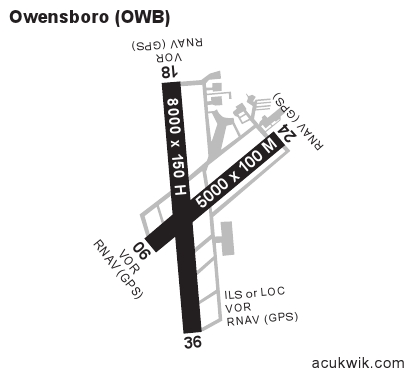
ILS GPS VOR
Longest Primary Runway (ft)
8000 x 150, 18/36
Runway Surface
Concrete/Grooved
PCN
Local Standard Time
6:27:34 AM
More Airport Information (Click to expand)
Airport Light Intensity
HIGH
US Customs Pre-Clearance
No
DST
2nd Sun in Mar 0200L to 1st Sun in Nov 0200L
Control Tower Hours
0600-2200L
Distance from City
3 MILES SW OF CITY
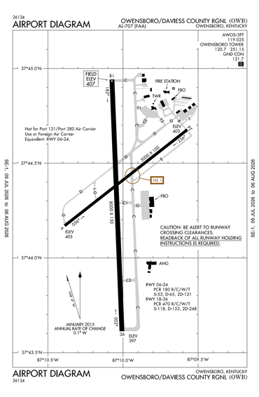
Runway Diagram
FAA Diagram
Google Satellite Map of KOWB
Airport Distance Calculator
The distance from to is
Nautical Miles
Airport Restrictions and Information
Fuel Info
Brand WORLD FUEL
Fuel Info
Brand TITAN
Prices Not Updated Last 90 DAYS
Prices Not Updated Last 90 DAYS
Hotels
Hampton Inn Owensboro South
Holiday Inn Exp Owensboro