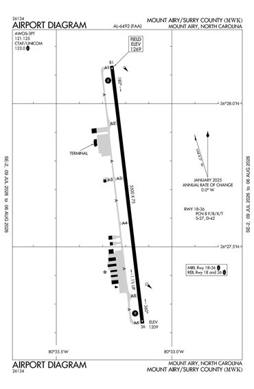
KMWK - Mount Airy/Surry County
Located in Mount Airy, NC, USA
ICAO - KMWK, FAA ID - MWK
Airport Type
Civil
Lat/Long
N36-27.7/W080-33.2
Elevation (ft)
1269
Fuel Available
AVGAS JET
Current UTC
3:40:32 PM (-5.00)
Approaches
GPS
Longest Primary Runway (ft)
5500 x 75, 18/36
Runway Surface
Asphalt
PCN
Local Standard Time
11:40:32 AM
More Airport Information (Click to expand)
Airport Light Intensity
MEDIUM
US Customs Pre-Clearance
No
DST
2nd Sun in Mar 0200L to 1st Sun in Nov 0200L
Airport Hours
0800L - until first of 1800 or Sunset
Distance from City
3 MILES SE OF CITY
FAA Diagram
Google Satellite Map of KMWK
Airport Distance Calculator
The distance from to is
Nautical Miles
Airport Restrictions and Information
Fuel Info
Brand PHILLIPS 66