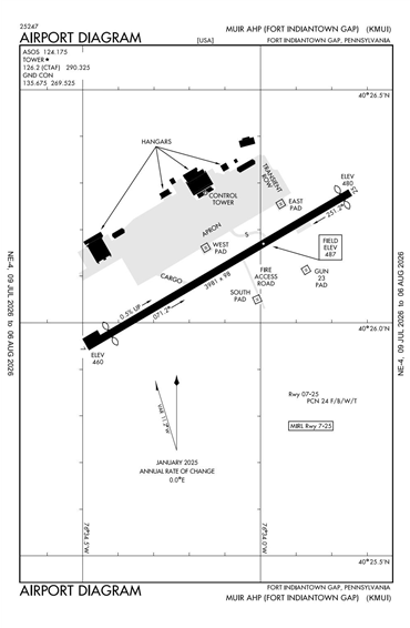
KMUI - Muir AAF (Fort Indiantown Gap)
Located in Fort Indiantown Gap (Annville), PA, USA
ICAO - KMUI, IATA - MUI, FAA ID - MUI
Airport Type
Military
Lat/Long
N40-26.1/W076-34.1
Elevation (ft)
487
Fuel Available
NO FUEL
Current UTC
11:32:26 AM (-5.00)
Approaches
VFR
Longest Primary Runway (ft)
3981 x 98, 07/25
Runway Surface
Asphalt
PCN
Local Standard Time
7:32:26 AM
More Airport Information (Click to expand)
Airport Light Intensity
MEDIUM
US Customs Pre-Clearance
No
DST
2nd Sun in Mar 0200L to 1st Sun in Nov 0200L
Distance from City
6 MILES N OF CITY
FAA Diagram
Google Satellite Map of KMUI
Airport Distance Calculator
The distance from to is
Nautical Miles