KMKT - Mankato Regional
Located in Mankato, MN, USA
ICAO - KMKT, IATA - MKT, FAA ID - MKT
Airport Type
Civil
Lat/Long
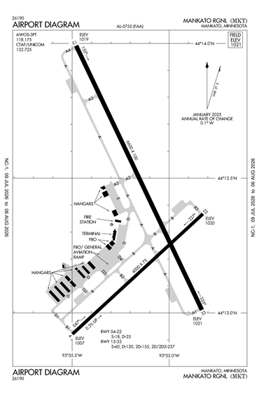
N44-13.4/W093-55.2
Elevation (ft)
1021
Fuel Available
AVGAS JET
Current UTC
1:02:53 PM (-6.00)
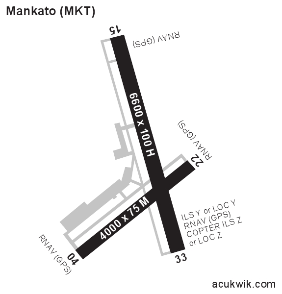
Approaches
ILS GPS VOR
Longest Primary Runway (ft)
6600 x 100, 15/33
Runway Surface
Concrete/Grooved
Local Standard Time
8:02:53 AM
More Airport Information (Click to expand)
Airport Light Intensity
HIGH
US Customs Pre-Clearance
No
DST
2nd Sun in Mar 0200L to 1st Sun in Nov 0200L
Airport Hours
M-F 0600-2200L, Sa-Su 0800-2000L
Distance from City
5 MILES NE OF CITY
Runway Diagram
FAA Diagram
Google Satellite Map of KMKT
Airport Distance Calculator
The distance from to is
Nautical Miles
Airport Restrictions and Information
Hotels
Country Inn & Suites Mankato
Holiday Inn Exp Mankato East
Hilton Garden Inn Mankato