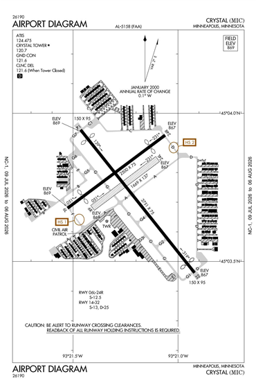
KMIC - Crystal
Located in Minneapolis, MN, USA
ICAO - KMIC, IATA - MIC, FAA ID - MIC
Airport Type
Civil
Lat/Long
N45-03.7/W093-21.2
Elevation (ft)
869
Fuel Available
AVGAS JET
Current UTC
4:46:45 AM (-6.00)
Approaches
GPS
Longest Primary Runway (ft)
3751 x 75, 14/32
Runway Surface
Asphalt
Local Standard Time
11:46:45 PM
More Airport Information (Click to expand)
Airport Light Intensity
MEDIUM
US Customs Pre-Clearance
No
DST
2nd Sun in Mar 0200L to 1st Sun in Nov 0200L
Control Tower Hours
7A-10P
Distance from City
8 MILES NW OF CITY
FAA Diagram
Google Satellite Map of KMIC
Airport Distance Calculator
The distance from to is
Nautical Miles
Airport Restrictions and Information
Fuel Info
Brand PHILLIPS 66