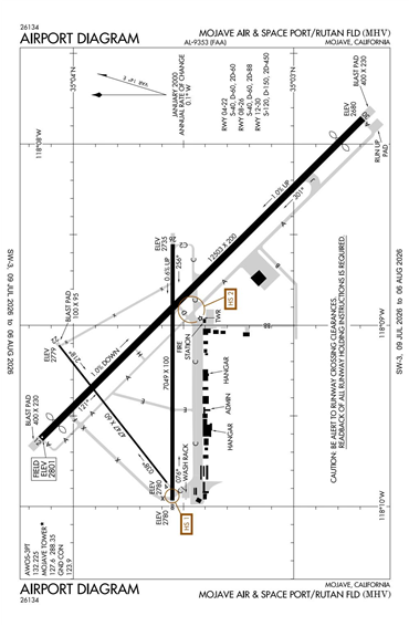
KMHV - Mojave Air & Space Port/Rutan Field
Located in Mojave, CA, USA
ICAO - KMHV, IATA - MHV, FAA ID - MHV
Airport Type
Civil
Lat/Long
N35-03.5/W118-09.0
Elevation (ft)
2801
Fuel Available
AVGAS JET
Current UTC
12:49:57 AM (-8.00)
Approaches
GPS
Longest Primary Runway (ft)
12503 x 200, 12/30
Runway Surface
Asphalt
Local Standard Time
5:49:57 PM
More Airport Information (Click to expand)
Airport Light Intensity
HIGH
US Customs Pre-Clearance
No
DST
2nd Sun in Mar 0200L to 1st Sun in Nov 0200L
Distance from City
1 MILE E OF CITY
FAA Diagram
Google Satellite Map of KMHV
Airport Distance Calculator
The distance from to is
Nautical Miles
Airport Restrictions and Information