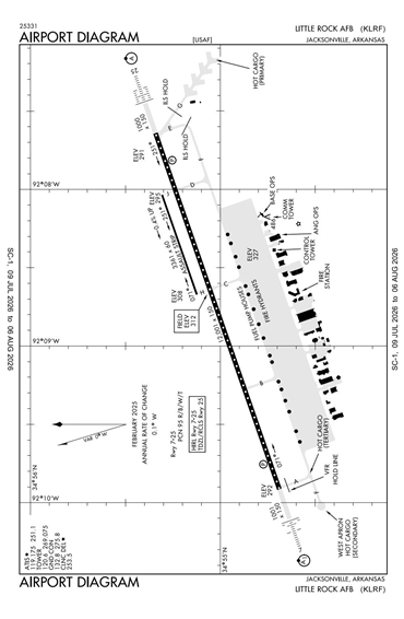
KLRF - Little Rock AFB
Located in Jacksonville, AR, USA
ICAO - KLRF, IATA - LRF, FAA ID - LRF
Airport Type
Military
Lat/Long
N34-55.1/W092-08.7
Elevation (ft)
309
Fuel Available
NO FUEL
Current UTC
12:47:46 AM (-6.00)
Approaches
PAR ILS NDB
Longest Primary Runway (ft)
12001 x 150, 07/25
Runway Surface
Concrete
PCN
Local Standard Time
7:47:46 PM
More Airport Information (Click to expand)
Airport Light Intensity
HIGH
US Customs Pre-Clearance
No
DST
2nd Sun in Mar 0200L to 1st Sun in Nov 0200L
Distance from City
1 MILE SE OF CITY
FAA Diagram
Google Satellite Map of KLRF
Airport Distance Calculator
The distance from to is
Nautical Miles
Airport Restrictions and Information