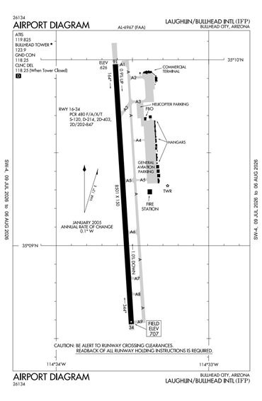
KIFP - Laughlin/Bullhead International
Located in Bullhead City, AZ, USA
ICAO - KIFP, IATA - IFP, FAA ID - IFP
Airport Type
Civil
Lat/Long
N35-09.3/W114-33.6
Elevation (ft)
707
Fuel Available
AVGAS JET
Current UTC
3:23:44 AM (-7.00)
Approaches
GPS VOR/DME
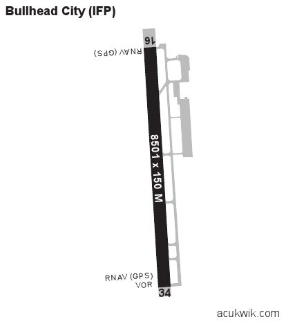
Longest Primary Runway (ft)
8501 x 150, 16/34
Runway Surface
Asphalt/Grooved
PCN
Local Standard Time
8:23:44 PM
More Airport Information (Click to expand)
Airport Light Intensity
MEDIUM
US Customs Pre-Clearance
No
DST
None (No Daylight Savings Time observed)
Control Tower Hours
0800-1800L
Distance from City
1 MILE N OF CITY
Runway Diagram
FAA Diagram
Google Satellite Map of KIFP
Airport Distance Calculator
The distance from to is
Nautical Miles
Airport Restrictions and Information
Fuel Info
Brand TITAN
Prices Not Updated Last 90 DAYS
Prices Not Updated Last 90 DAYS
Hotels
Riverside Resort & Casino