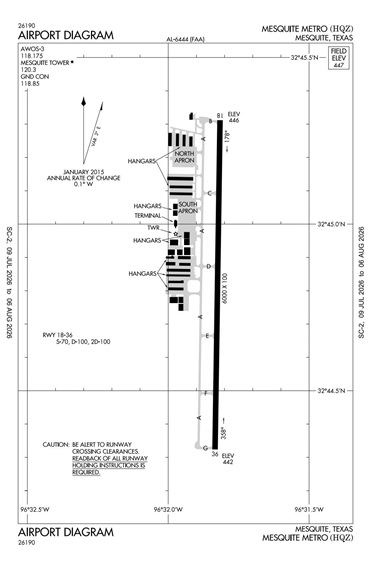
KHQZ - Mesquite Metro
Located in Mesquite, TX, USA
ICAO - KHQZ, FAA ID - HQZ
Airport Type
Civil
Lat/Long
N32-44.8/W096-31.8
Elevation (ft)
446
Fuel Available
AVGAS JET
Current UTC
2:36:40 AM (-6.00)
Approaches
GPS
Longest Primary Runway (ft)
6000 x 100, 18/36
Runway Surface
Concrete
Local Standard Time
9:36:40 PM
More Airport Information (Click to expand)
Airport Light Intensity
MEDIUM
US Customs Pre-Clearance
No
DST
2nd Sun in Mar 0200L to 1st Sun in Nov 0200L
Distance from City
3 MILES E OF CITY
FAA Diagram
Google Satellite Map of KHQZ
Airport Distance Calculator
The distance from to is
Nautical Miles
Airport Restrictions and Information
Fuel Info
Brand TITAN
Price/Gallon
Last Updated: 09 Jul 2026
Last Updated: 09 Jul 2026