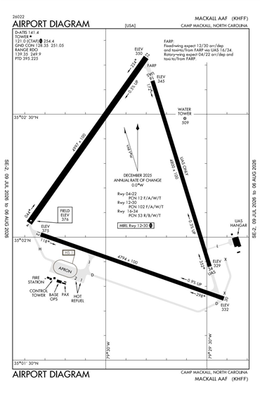
KHFF - Mackall AAF
Located in Camp Mackall, NC, USA
ICAO - KHFF, IATA - HFF, FAA ID - HFF
Airport Type
Military
Lat/Long
N35-02.2/W079-29.9
Elevation (ft)
376
Fuel Available
JET ONLY
Current UTC
3:37:48 PM (-5.00)
Approaches
VFR
Longest Primary Runway (ft)
5529 x 100, 16/34
Runway Surface
Concrete
PCN
Local Standard Time
11:37:48 AM
More Airport Information (Click to expand)
Airport Light Intensity
NO LIGHT
US Customs Pre-Clearance
No
DST
2nd Sun in Mar 0200L to 1st Sun in Nov 0200L
Distance from City
1 MILE E OF CITY
FAA Diagram
Google Satellite Map of KHFF
Airport Distance Calculator
The distance from to is
Nautical Miles