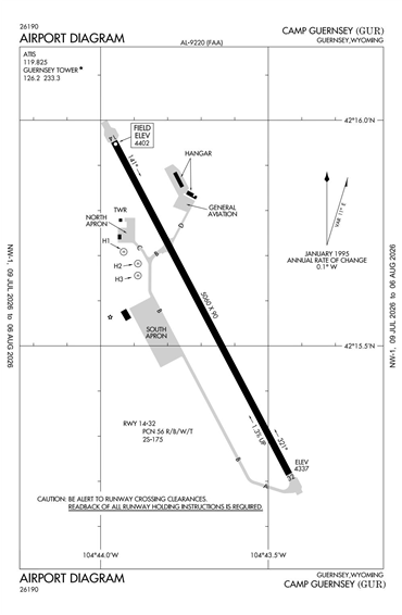
KGUR - Camp Guernsey
Located in Guernsey, WY, USA
ICAO - KGUR, FAA ID - GUR
Airport Type
Civil
Lat/Long
N42-15.6/W104-43.7
Elevation (ft)
4402
Fuel Available
JET ONLY
Current UTC
4:37:58 PM (-7.00)
Approaches
GPS NDB
Longest Primary Runway (ft)
5060 x 90, 14/32
Runway Surface
Asphalt/PFC
PCN
Local Standard Time
10:37:58 AM
More Airport Information (Click to expand)
Airport Light Intensity
MEDIUM
US Customs Pre-Clearance
No
DST
2nd Sun in Mar 0200L to 1st Sun in Nov 0200L
Control Tower Hours
0800-1700L
Distance from City
1 MILE SE OF CITY
FAA Diagram
Google Satellite Map of KGUR
Airport Distance Calculator
The distance from to is
Nautical Miles
Airport Restrictions and Information