KFST - Fort Stockton-Pecos County
Located in Fort Stockton, TX, USA
ICAO - KFST, IATA - FST, FAA ID - FST
Airport Type
Civil
Lat/Long
N30-54.9/W102-54.8
Elevation (ft)
3011
Fuel Available
AVGAS JET
Current UTC
7:44:01 AM (-6.00)
Approaches
GPS VOR/DME
Longest Primary Runway (ft)
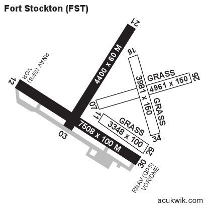
7508 x 100, 12/30
Runway Surface
Asphalt
Local Standard Time
2:44:01 AM
More Airport Information (Click to expand)
Airport Light Intensity
MEDIUM
US Customs Pre-Clearance
No
DST
2nd Sun in Mar 0200L to 1st Sun in Nov 0200L
Distance from City
2 MILES NW OF CITY
Runway Diagram
Google Satellite Map of KFST
Airport Distance Calculator
The distance from to is
Nautical Miles
Airport Restrictions and Information