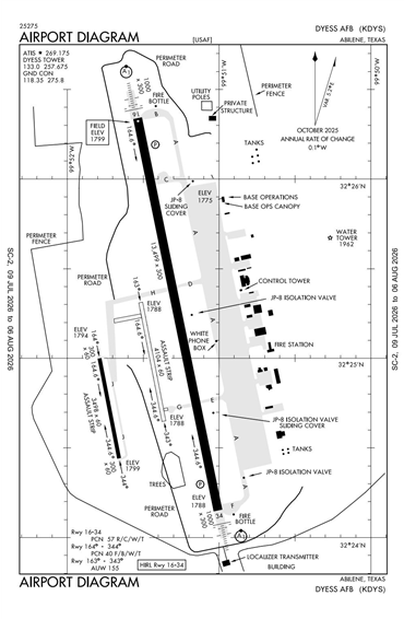
KDYS - Dyess AFB
Located in Abilene, TX, USA
ICAO - KDYS, IATA - DYS, FAA ID - DYS
Airport Type
Military
Lat/Long
N32-25.1/W099-51.4
Elevation (ft)
1790
Fuel Available
JET ONLY
Current UTC
4:27:25 AM (-6.00)
Approaches
ILS VOR
Longest Primary Runway (ft)
13500 x 300, 16/34
Runway Surface
Concrete
PCN
Local Standard Time
11:27:25 PM
More Airport Information (Click to expand)
Airport Light Intensity
HIGH
US Customs Pre-Clearance
No
DST
2nd Sun in Mar 0200L to 1st Sun in Nov 0200L
Airport Hours
Mon-Fri 1300-0700Z
Control Tower Hours
Mon-Fri 1300-0700Z
Distance from City
5 MILES SW OF CITY
FAA Diagram
Google Satellite Map of KDYS
Airport Distance Calculator
The distance from to is
Nautical Miles
Airport Restrictions and Information