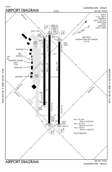
KDLF - Laughlin AFB
Located in Del Rio, TX, USA
ICAO - KDLF, IATA - DLF, FAA ID - DLF
Airport Type
Military
Lat/Long
N29-21.6/W100-46.7
Elevation (ft)
1082
Fuel Available
NO FUEL
Current UTC
3:24:13 AM (-6.00)
Approaches
ILS LOC GPS
Longest Primary Runway (ft)
8852 x 150, 13C/31C
Runway Surface
Asphalt/Concrete
PCN
Local Standard Time
10:24:13 PM
More Airport Information (Click to expand)
Airport Light Intensity
HIGH
US Customs Pre-Clearance
No
DST
2nd Sun in Mar 0200L to 1st Sun in Nov 0200L
Airport Hours
Mon-Fri 1300-0100Z, Sun 2000-2300Z
Control Tower Hours
SEE AIRPORT HOURS
Distance from City
5 MILES E OF CITY
FAA Diagram
Google Satellite Map of KDLF
Airport Distance Calculator
The distance from to is
Nautical Miles
Airport Restrictions and Information