KDIJ - Driggs/Reed Memorial
Located in Driggs, ID, USA
ICAO - KDIJ, FAA ID - DIJ
Airport Type
Civil
Lat/Long
N43-44.8/W111-05.5
Elevation (ft)
6257
Fuel Available
AVGAS JET
Current UTC
6:22:34 PM (-7.00)
Approaches
GPS
Longest Primary Runway (ft)
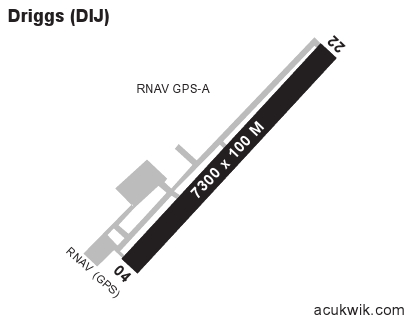
7301 x 100, 04/22
Runway Surface
Asphalt
PCN
Local Standard Time
12:22:34 PM
More Airport Information (Click to expand)
Airport Light Intensity
MEDIUM
US Customs Pre-Clearance
No
DST
2nd Sun in Mar 0200L to 1st Sun in Nov 0200L
Distance from City
1 MILE N OF CITY
Runway Diagram
Google Satellite Map of KDIJ
Airport Distance Calculator
The distance from to is
Nautical Miles
Airport Restrictions and Information
Hotels
Teton Springs Lodge & Spa