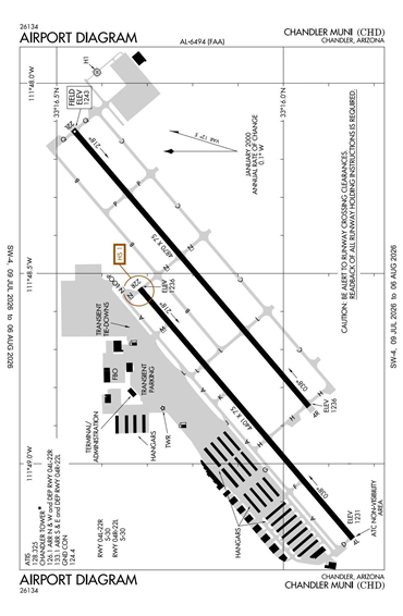
KCHD - Chandler Municipal
Located in Chandler, AZ, USA
ICAO - KCHD, FAA ID - CHD
Airport Type
Civil
Lat/Long
N33-16.1/W111-48.7
Elevation (ft)
1243
Fuel Available
AVGAS JET
Current UTC
7:40:15 PM (-7.00)
Approaches
GPS VOR NDB
Longest Primary Runway (ft)
4870 x 75, 04R/22L
Runway Surface
Asphalt
PCN
Local Standard Time
12:40:15 PM
More Airport Information (Click to expand)
Airport Light Intensity
MEDIUM
US Customs Pre-Clearance
No
DST
None (No Daylight Savings Time observed)
Control Tower Hours
0600-2100L
Distance from City
3 MILES SE OF CITY
FAA Diagram
Google Satellite Map of KCHD
Airport Distance Calculator
The distance from to is
Nautical Miles
Airport Restrictions and Information
Fuel Info
Brand INDEPENDENT