KBXK - Buckeye Municipal
Located in Phoenix, AZ, USA
ICAO - KBXK, IATA - BXK, FAA ID - BXK
Airport Type
Civil
Lat/Long
N33-25.4/W112-41.2
Elevation (ft)
1033
Fuel Available
AVGAS JET
Current UTC
7:36:36 PM (-7.00)
Approaches
VFR
Longest Primary Runway (ft)
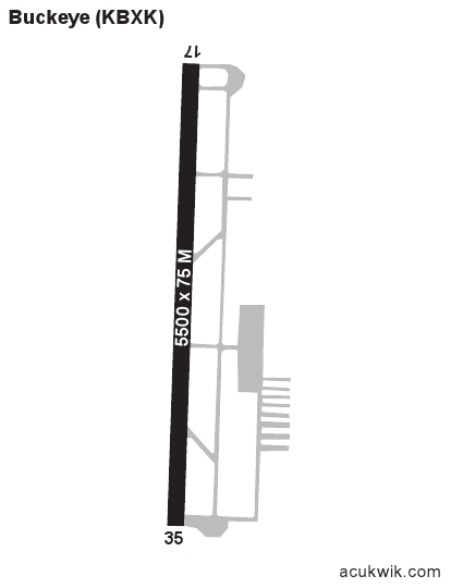
5500 x 75, 17/35
Runway Surface
Asphalt
Local Standard Time
12:36:36 PM
More Airport Information (Click to expand)
Airport Light Intensity
MEDIUM
US Customs Pre-Clearance
No
DST
None (No Daylight Savings Time observed)
Distance from City
6 MILES NW OF CITY
Runway Diagram
Google Satellite Map of KBXK
Airport Distance Calculator
The distance from to is
Nautical Miles
Airport Restrictions and Information
Fuel Info
Brand PHILLIPS 66