KBMI - Central Illinois Regional at Bloomington Normal
Located in Bloomington, IL, USA
ICAO - KBMI, IATA - BMI, FAA ID - BMI
Airport Type
Civil
Lat/Long
N40-28.6/W088-55.0
Elevation (ft)
871
Fuel Available
AVGAS JET
Current UTC
9:01:20 AM (-6.00)
Approaches
ILS/DME GPS
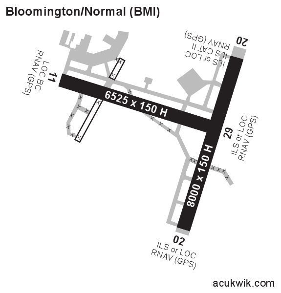
Longest Primary Runway (ft)
8000 x 150, 02/20
Runway Surface
Concrete/Grooved
PCN
Local Standard Time
4:01:20 AM
More Airport Information (Click to expand)
Airport Light Intensity
HIGH
US Customs Pre-Clearance
No
DST
2nd Sun in Mar 0200L to 1st Sun in Nov 0200L
Control Tower Hours
0600-2300L
Distance from City
3 MILES E OF CITY
Runway Diagram
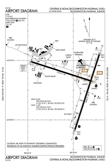
FAA Diagram
Google Satellite Map of KBMI
Airport Distance Calculator
The distance from to is
Nautical Miles
Airport Restrictions and Information
Fuel Info
Brand AVFUEL
Price/Gallon
Last Updated: 21 Jul 2026
Last Updated: 21 Jul 2026