KAWO - Arlington Municipal
Located in Arlington, WA, USA
ICAO - KAWO, FAA ID - AWO
Airport Type
Civil
Lat/Long
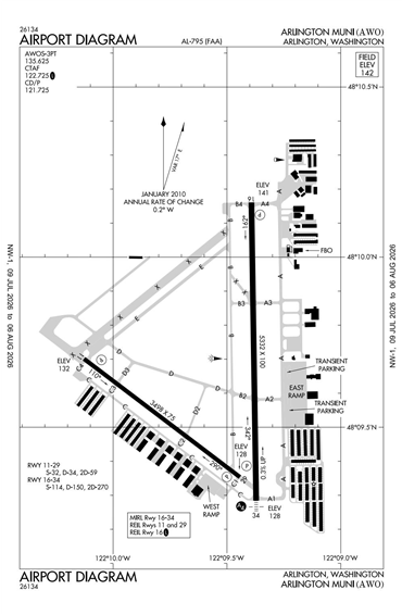
N48-09.6/W122-09.5
Elevation (ft)
142
Fuel Available
AVGAS JET
Current UTC
8:56:49 AM (-8.00)
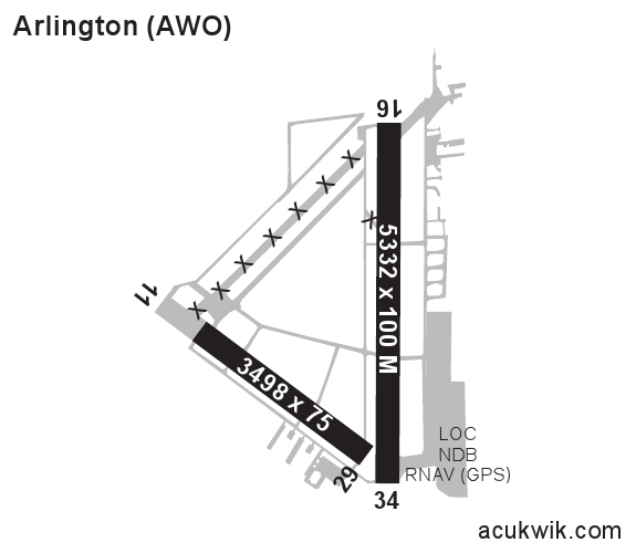
Approaches
LOC GPS NDB
Longest Primary Runway (ft)
5332 x 100, 16/34
Runway Surface
Asphalt
Local Standard Time
1:56:49 AM
More Airport Information (Click to expand)
Airport Light Intensity
MEDIUM
US Customs Pre-Clearance
No
DST
2nd Sun in Mar 0200L to 1st Sun in Nov 0200L
Distance from City
3 MILES SW OF CITY
Runway Diagram
FAA Diagram
Google Satellite Map of KAWO
Airport Distance Calculator
The distance from to is
Nautical Miles
Airport Restrictions and Information
Fuel Info
Brand INDEPENDENT