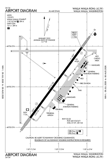
KALW - Walla Walla Regional
Located in Walla Walla, WA, USA
ICAO - KALW, IATA - ALW, FAA ID - ALW
Airport Type
Civil
Lat/Long
N46-05.6/W118-17.0
Elevation (ft)
1194
Fuel Available
AVGAS JET
Current UTC
7:29:44 AM (-8.00)
Approaches
ILS LOC GPS
Longest Primary Runway (ft)
6527 x 150, 02/20
Runway Surface
Concrete/Grooved
PCN
Local Standard Time
12:29:44 AM
More Airport Information (Click to expand)
Airport Light Intensity
HIGH
US Customs Pre-Clearance
No
DST
2nd Sun in Mar 0200L to 1st Sun in Nov 0200L
Control Tower Hours
0600-1830L
Distance from City
3 MILES NE OF CITY
FAA Diagram
Google Satellite Map of KALW
Airport Distance Calculator
The distance from to is
Nautical Miles
Airport Restrictions and Information
Fuel Info
Brand WORLD FUEL