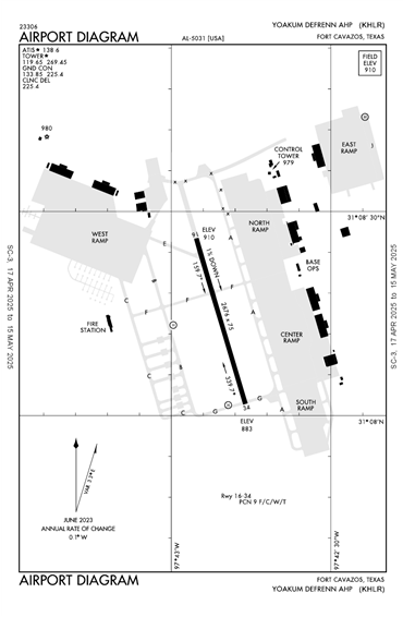
KHLR - Yoakum-Defrenn Ahp
Located in Fort Cavazos (Killeen), TX, USA
ICAO - KHLR, FAA ID - HLR
Airport Type
Military
Lat/Long
N31-08.3/W097-42.8
Elevation (ft)
910
Fuel Available
NO FUEL
Current UTC
12:43:11 AM (-6.00)
Approaches
VFR
Longest Primary Runway (ft)
2676 x 75, 16/34
Runway Surface
Asphalt
PCN
Local Standard Time
7:43:11 PM
More Airport Information (Click to expand)
Airport Light Intensity
MEDIUM
US Customs Pre-Clearance
No
DST
2nd Sun in Mar 0200L to 1st Sun in Nov 0200L
Distance from City
1 MILE NE OF CITY
FAA Diagram
Google Satellite Map of KHLR
Airport Distance Calculator
The distance from to is
Nautical Miles