EGAA - Belfast International (Aldergrove)
Located in Belfast, UNITED KINGDOM
ICAO - EGAA, IATA - BFS
Airport Type
Civil
Lat/Long
N54-39.5/W006-13.0
Elevation (ft)
268
Fuel Available
AVGAS JET
Current UTC
4:51:52 AM (0.00)
Approaches
ILS VOR/DME
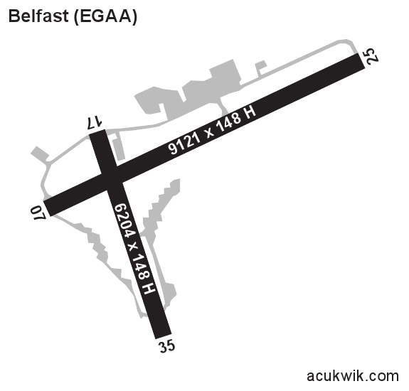
Longest Primary Runway (ft)
9121 x 148, 07/25
Runway Surface
Asphalt/Grooved
PCN
Local Standard Time
5:51:52 AM
More Airport Information (Click to expand)
Airport Light Intensity
HIGH
US Customs Pre-Clearance
No
DST
Last Sun in Mar 0100Z to last Sun in Oct 0100Z
Distance from City
21 KM NW OF CITY
Runway Diagram
Google Satellite Map of EGAA
Airport Distance Calculator
The distance from to is
Nautical Miles
Airport Restrictions and Information
SMA LEVEL 2 - SCHEDULES FACILITATED
SMA LEVEL 2 - SCHEDULES FACILITATED