KCPT - Cleburne Regional
Located in Cleburne, TX, USA
ICAO - KCPT, FAA ID - CPT
Airport Type
Civil
Lat/Long
N32-21.2/W097-26.0
Elevation (ft)
854
Fuel Available
AVGAS JET
Current UTC
6:34:44 AM (-6.00)
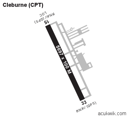
Approaches
LOC/DME GPS
Longest Primary Runway (ft)
5697 x 100, 15/33
Runway Surface
Asphalt
Local Standard Time
1:34:44 AM
More Airport Information (Click to expand)
Airport Light Intensity
MEDIUM
US Customs Pre-Clearance
No
DST
2nd Sun in Mar 0200L to 1st Sun in Nov 0200L
Distance from City
2 MILES NW OF CITY
Runway Diagram
Google Satellite Map of KCPT
Airport Distance Calculator
The distance from to is
Nautical Miles
Airport Restrictions and Information